
DK Publishing (Dorling Kindersley)
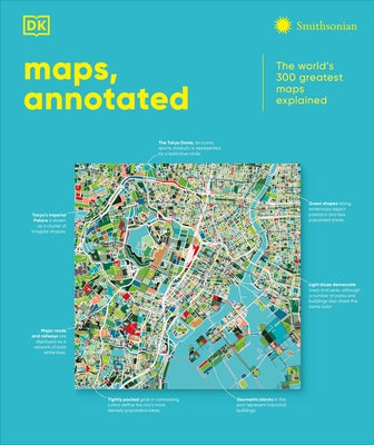
Maps, Annotated: The World's 300 Greatest Maps Explained
Maps, Annotated: The World's 300 Greatest Maps Explained
Regular price
$60.00
Regular price
Sale price
$60.00
Unit price
per
Shipping calculated at checkout.
Couldn't load pickup availability
This fascinating history of cartography includes more than 300 maps, from the ancient world to the present day. Combining stunning reproductions with clear annotations and pull-out details, it is an expertly curated selection of the finest examples ever created. Delve into Maps, Annotated and find out how the Polynesians used sticks to chart their way across the Pacific, what a meridian is, and where dragons were said to lurk. Discover ancient Chinese star maps, decipher medieval Mappa Mundi, and find out how the world is split into time zones. Organized chronologically, the book features maps from all over the world, explaining key elements such as compasses, scales, symbols, and geographic features. Each map is also set in historical context, making Maps, Annotated a complete overview of the history of cartography. From Babylonian world maps to the Aztec map of Tenochtitlán and the Gaia map of the Milky Way, immerse yourself in the most intriguing maps ever created. Comprehensive and lavishly illustrated, Maps, Annotated is a must for all armchair explorers.
Author: DK
Binding Type: Hardcover
Publisher: DK Publishing (Dorling Kindersley)
Published: 10/21/2025
Series: DK Annotated
Pages: 480
Weight: 5.3lbs
Size: 11.20h x 9.40w x 1.50d
ISBN: 9798217126316
Author: DK
Binding Type: Hardcover
Publisher: DK Publishing (Dorling Kindersley)
Published: 10/21/2025
Series: DK Annotated
Pages: 480
Weight: 5.3lbs
Size: 11.20h x 9.40w x 1.50d
ISBN: 9798217126316